Sharon Road
So who was Sharon?
And why are all those roads named after her?
At the Levine Museum of the New South, visitors often ask us about Charlotte’s confusing streetnames. Why, they especially want to know, are so many roads in south Charlotte named “Sharon?”
The answer to that question appeared recently when Ozzie Ayscue, Jr., longtime attorney at uptown’s Helms-Mullis lawfirm, brought in a topographic map of Charlotte and environs drawn back in 1905. One of the earliest products of the United States Geological Survey, it shows every hill and stream, every road and rail line, and even hundreds of tiny buildings just as they existed almost a century ago.
The map captures Charlotte’s “built environment” in the very first years of suburban growth. To the south, farmland begins just beyond Dilworth, the city’s initial suburb. There is no hint of Myers Park, or Foxcroft, or the SouthPark mall area, or all the neighborhoods that now sprawl southward toward Highway 51. Except….
There’s a country crossroads with a tiny building labeled “Sharon Church.” That’s Sharon Presbyterian, already 74 years old in 1905.
So who was Sharon? The answer comes from the Bible, where “Sharon” was a place, rather than a person. In Biblical times, the coastal plain of Palestine — now modern day Israel — along the Mediterranean Ocean was known as Sharon. The Book of Isaiah promises, “My servants shall dwell there. Sharon shall become a pasture for flocks, and … a place for herds to lie down, for my people who have sought me.”
What a perfect image for settlers arriving in the Carolina wilderness! No wonder the early farmers chose the name “Sharon” for their church.
Ok, but how did Sharon Presbyterian’s name get attached to what seems like every second street in southeast Charlotte?
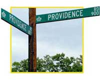
In pre-suburban days, churches were about the only landmarks out in the countryside of Mecklenburg County. So roads tended to be named for the churches they led to or ran past. (Some other examples — Providence Road, leading out to Providence Presbyterian; Sugar Creek Road, passing Sugar Creek Presbyterian).
Around Sharon Church two major roads were Sharon Road, which wandered south from Charlotte out to the church, and Sharon-Amity, which ran from that church northwestward to the next church, Amity Presbyterian (established in 1882 just off Albemarle Road).
All quite simple and clear in farming days — but then came suburbanization.
Cameron Morrison, wealthy North Carolina governor, built a showplace farm called “Morrocroft” near the Sharon/Sharon Amity intersection in the 1920s. Other upscale houses followed. After World War II some of those folks started a country club, which they dubbed “Sharonview.”
Soon fancy new suburbs were springing up with streetnames trumpeting their prestigious location. Look at a map today and you’ll find Sharon Acres Road, Sharon Avenue, Sharon Chase Drive, Sharon Commons Lane, Sharon Forest Drive, Sharon Lakes Road, Sharon Oaks Lane, and Sharon Parkway.
Not to mention Sharon View Road and Sharonview Court, Sharon Woods Lane, Sharon on Wrenfield Drive, and Sharonbrook Drive.
Confusing? Certainly. But it helped developers sell houselots.
Today SouthPark shopping center covers Cameron Morrison’s old fields. The historic brick sanctuary of Sharon Presbyterian Church does still stand, hidden quietly in the trees just south of the mall. But few passersby recall the days when Sharon was truly “a pasture for flocks.”
— Tom Hanchett, Charlotte Observer, September 2002 – used with permission

Here’s a little history of just a few of Charlotte’s streets:
Sharon Road
Wilkinson Blvd
Central Avenue
Presbyterian Streets
Barringer Drive
